An application that allows users to find and order satellite imagery for a variety of applications
Digital satellite imagery has a wide range of uses, spanning from environmental monitoring and resource management to disaster response and urban planning. It provides a unique perspective on Earth’s surface, enabling users to observe changes, track trends, and analyze various phenomena over time.
The Problem: How to make satellite imagery more accessible, understandable, and relevant to a broader base of users (not just geospatial engineers)
The solution: Create a public facing tool that educates users on the possibilities and applications for satellite imagery and guide them to products they can purchase for use
- Dealing with Subject Matter Experts that did not agree on anything. Several meetings came close to throwing punches – not an exaggeration
Solution: Duck! Not really. We quickly learned to schedule separate meetings with each SME and bring them together only when we had gathered information from all parties, built and tested the prototype, and had objective user feedback to present. - Unexpected Scope Increase. The company had fired a previous agency who had produced a 40+ page Powerpoint containing months of research and findings. Our understanding was that their research was good, but their design was not and that we would pick up where they left off. In the first client meeting they literally took the deck and threw it in the trash can stating, ‘don’t even look at this thing’.
Solution: Over lunch the Project Lead, whom I’d just met, and myself called the office, explained the situation, and agreed that we would come out to Colorado, where they were located, every week for 3 – 4 days a week so that we could meet their proposed deadline.
- I was unable to obtain any results/numbers for this project
Users: Telecommunication Planners, City Planners,Automotive Product Managers, Geospatial Analysts
- Subject Matter Expert interviews
- Experience Mapping
- Wireframes, Comps, Prototypes
- Iterative design: discovery, design/build, and review
- Sr. Product Designer (Me)
- 1 UX Researcher
- 1 Project Lead
- 1 Graphic Designer
- 1 Front-end Developer
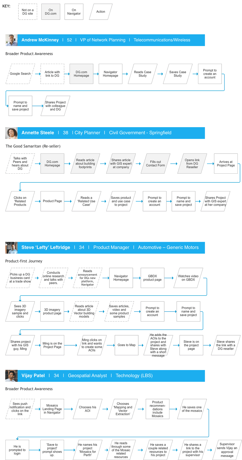
User Scenarios
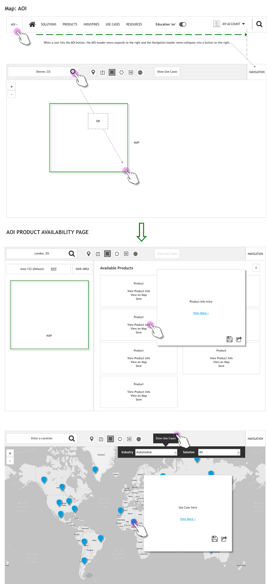
Wireframe for Area of Interest Overlay
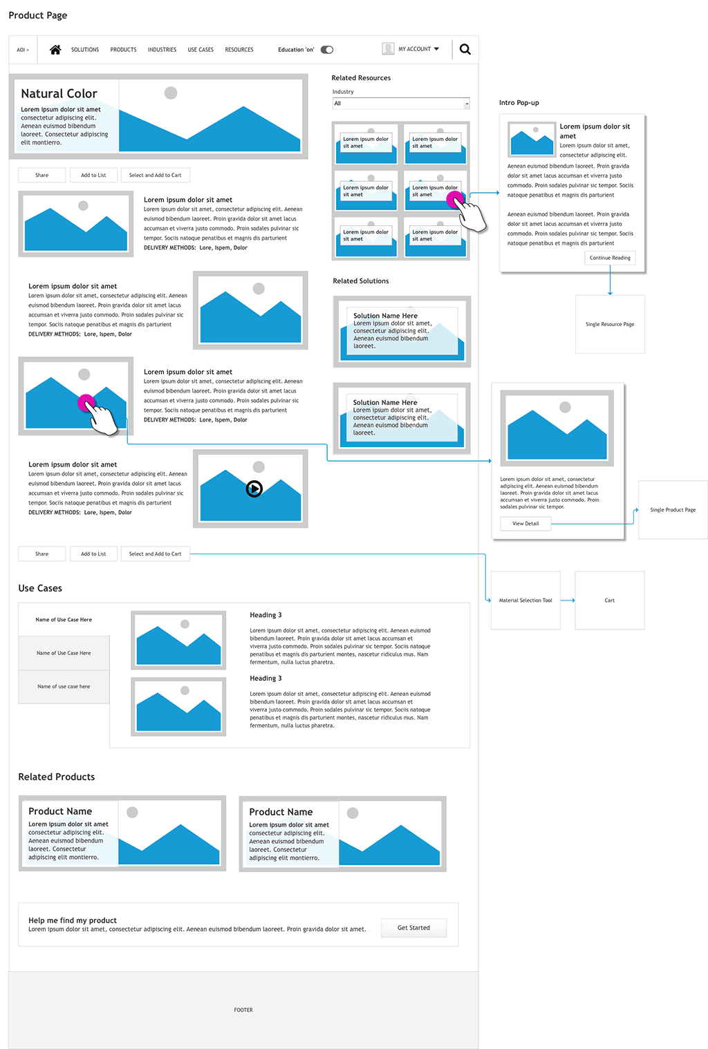
Wireframe for Product Page
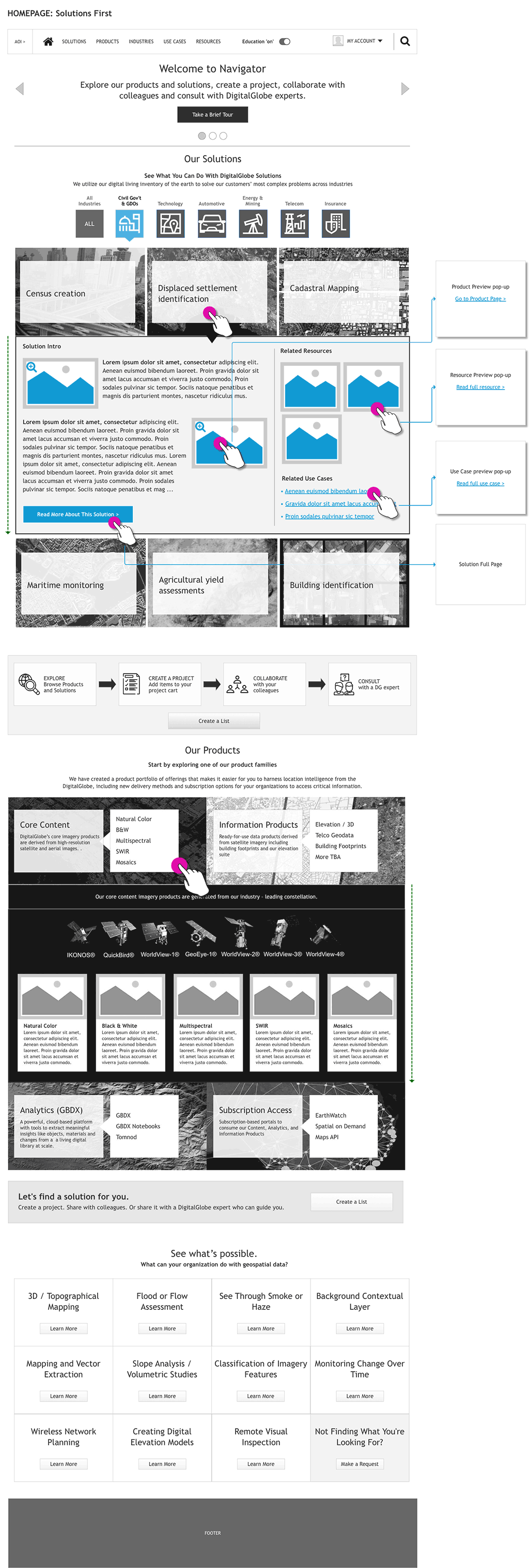
Wireframe for Home Screen

Wireframe for Homepage Expanding Sections and Links